Floodplain Information
The City of Roseburg is a participating community in the National Flood Insurance Program (NFIP) and the Community Rating System. As part of our participation in the NFIP, the City maintains copies of elevation certificates for properties located in the Special Flood Hazard Areas (SFHA). Copies of elevation certificates and other relevant documents on file can be downloaded and printed from the Map Search Tool below. Please call the Community Development Department at 541-492-6750, during normal business hours for additional information or assistance.
How to Use the Map Search Tool:
- Click the search icon in the top right corner of the map to look up a property by street address, or property ID number (R######)

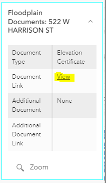
- Click on the document icon to bring up more information about the property.

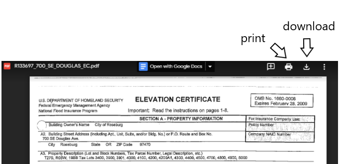
- Click on "View" in the Document Link column to access a copy of an elevation certificate / letter of map amendment. Documents can be downloaded and printed from Google Drive.
Other Tips:
- Mobile and tablet users may click "View larger map" for an optimized search experience.
- Change the base map to satellite imagery by clicking the preview in the bottom left corner of the map.

- Toggle the visibility of items on the map using the "Layers" tab.
- To return to the original extent of the map, click on the home button in the top left corner.

**Note: The Map Search Tool is currently under development. Not all floodplain documents may show up in the current version of this tool. This tool only contains documents for properties within the Roseburg City Limits. To find information for nearby areas, please visit Douglas County's website.
About Elevation Certificates
The Federal Emergency Management Agency (FEMA) defines elevation certificates as an official record that shows new buildings and substantial improvements are properly elevated in the SFHAs. This elevation information shows compliance with the City’s floodplain ordinance. The elevation certificate is developed by FEMA and is a tool that property owners can use to obtain flood insurance. Elevation certificates must be prepared and certified by a Licensed Land Surveyor, Registered Professional Engineer, or architect to certify elevation information. The City of Roseburg is required to maintain copies of elevation certificates as part of our participation in the Community Rating System program.
The latest version of the FEMA elevation certificate can be found on the fema.gov website.